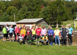
 A
Grand Touring ride is a group social ride. Ride Leaders ride with the group
and provide directions and support to the riders. Routes are not marked.
Maps and/or Cue Sheets will be provided. Grand Touring rides are often at
remote locations an hour or more distant from Central Indiana and often focus
on festivals, museums, restaurants and other similar tourist attractions.
A
Grand Touring ride is a group social ride. Ride Leaders ride with the group
and provide directions and support to the riders. Routes are not marked.
Maps and/or Cue Sheets will be provided. Grand Touring rides are often at
remote locations an hour or more distant from Central Indiana and often focus
on festivals, museums, restaurants and other similar tourist attractions.
Grand Touring riders support local businesses
for food and facilities. Typically ten to twenty riders will attend a Grand
Touring ride. Riding is at a moderate pace and riders try to stay together.
Nobody is left by themselves unless that is what the rider wants.
Grand Touring Ride Philosophy: To emphasize the enjoyment of bicycling as a group and social activity and as a method to explore and discover Indiana and other destinations.
If the weather is not suitable for riding, Grand Touring ride leaders may cancel the ride since riders usually drive long distances to attend rides. Please contact the ride leader before leaving home if the weather looks questionable. Other types of CIBA rides can be found at www.cibaride.org.
 Grand Touring Ride Leader Guidelines
Grand Touring Maps & Cue Sheets
Map and cue sheets are intended for individual personal use. If you would like to use the map and cue sheets for an organized event, please contact the ride leader.
2013 Grand Touring Ride Calendar
Note: Grand Touring Ride Leaders - This is the current information that I have for Grand Touring Rides. If a correction needs to be made or I need to add your ride, please contact me at rsdesign@ieee.org with your updates and I will be happy to add them to the Grand Touring Ride Calendar.
April
Metamora Redbud Ramble
Date: Saturday, April 27, 2013
Start Time: 10:00 am
Ride Leaders: Randy and Connie Schmucker, 317-257-5607, cell: 317-777-9630, rsdesign@ieee.org
Route Lengths: 26 and 48 miles - hilly terrain
Start Location: Metamora, IN: Visitor parking, (Public Restrooms on top
of the hill)
entry sign to parking lot reads
“ Whitewater Canal State Historic Site Indiana State Museum System Visitor
Parking”
Directions to Start: From I-465, take I-74 east. Turn left on south S.R. 229. Turn right on east S.R. 52. In Metamora turn right on Duck Creek Rd and follow 2 blocks to parking lot.
Ride Description: This tour takes in the scenic Whitewater River valley and hills in scenic southeastern Indiana while the redbuds are in full bloom. Metamora is one of the villages on the historic Whitewater canal and the Duck Creek Aqueduct can still be seen as well as portions of the canal. You can even take a ride on the canal. If shopping is your pleasure, after the ride we’ll go feast in one of the many restaurants and then shop until you drop at the abundant craft houses. Metamora's website: www.metamoraindiana.com. Contact Ride Leaders if the weather is questionable before making the trip.
May
Eastern Brown County Dogwood Meander
Date: Saturday, May 4, 2013
Start Time: 9:30 am
Ride Leaders: Randy and Connie Schmucker, 317-257-5607, cell: 317-777-9630, rsdesign@ieee.org
Route Lengths: 36 and 50 miles - hilly terrain
Start Location: Columbus, IN: Jay C Food parking lot - SR 46 & Goeller
Rd
Directions to start: I-65 South. Exit west on SR 46, go 0.5 miles, turn right
at light, Goeller Rd, into parking lot
Ride Description: Enjoy a nice spring day with the dogwoods and spring flowers in full bloom in the hills of western Bartholomew County and eastern Brown County. This ride will meander through Grandview Lake, Pikes Peak, Hoosier National Forest and other Indiana back road delights. A stop at Crouch’s market for homemade sandwichs and pie is a must to reload those carbs and then after the ride we will stop at Dags for ice cream! Contact Ride Leaders if the weather is questionable before making the trip.
July
Summertime Hills Frolic
Date: Saturday, July 20, 2013
Start Time: 9:00 am
Ride Leaders: Randy and Connie Schmucker, 317-257-5607, cell: 317-777-9630, rsdesign@ieee.org
Route Lengths: 36 and 49 miles - hilly terrain
Start Location: Columbus, IN: Jay C Food parking lot - SR 46 & Goeller
Rd
Directions to start: I-65 South. Exit west on SR 46, go 0.5 miles, turn right
at light, Goeller Rd, into parking lot
Ride Description: Wander and roll through the scenic hills and views around Beck's Grove, Pike's Peak and Rinnie Sietz in western Bartholomew county and eastern Brown county. There will be lots of shade. The lunch stop at Crouch’s market features handmade sandwiches and homemade desserts. After rolling around Grandview Lake refresh yourself with ice cream and goodies at Dags. Contact Ride Leaders if the weather is questionable before making the trip.
August
Labor Day Weekend Triple Header + One
Date: August 30 & 31, Septmeber 1, 2013
Start Time: See each day's description
Ride Leaders: Warren Smock, 317-417-3961, warsmockren@hotmail.com
Joe Hettle, 317-496-5516, jhettle@gmail.com
Ride Lengths: 20 - 50 miles
Start Location: Holiday Inn Express, 249 Federal Drive NW, Corydon, IN 47112.
Phone: 812-738-1623
Directions: (From Indianapolis)
- I-65 south to I-265
- I-264 west to 1-64
- I-64 west to exit 105 (SR 135)
- Take exit 105, and then turn right on IN. St Rd.135.
- Right on Federal Drive NW, very near the Super Wal-Mart.
Hotel Arrangements: I have a block of 10 rooms on hold at the Holiday Inn
Express with a special rate of $ 81.00 per night. You must make your own
reservation and mention Central Indiana Bicycling Association or CBA to get
the special rate. The hotel will hold these rooms until August 19th. Their
web site is www.hiexpress.com/hotels/us/en/corydon/cydin/hoteldetail.
Most major chains also have hotels within a reasonable distance of the start.
Ride Description: This will be four days of bicycling in southern Indiana. Distances will be about 50 miles with shorter options. Monday’s ride will be a little shorter, 35 to 40, to allow an early start for the drive home. There will be three days and different road rides; see below. All road bicycling will be on good roads with many ripples and a few larger bumps and a couple of hills.
RSVP, although not required, would be appreciated so I have some idea of how many are coming.
Many other recreational opportunities exist in the area if you want to come down and not ride all four days.
Friday: A short ride evening ride from the hotel for ice cream and
maybe dinner.
Saturday: Details to follows but plan on about 50 miles with shorter
cut offs available.
Sunday: Ride will take us to Turtle Run Winery Tour 50 miles (+
or -) with a shorter option available.
Monday: Short morning ride of 30 to 40 miles to get us back
to Hotel for a late check out and showers before heading for home.
Additional details of the ride available in mid summer.
September
Metamora Mystery Ride (Title TBA)
Date: Saturday, September 7, 2013
Start Time: TBA
Ride Leaders: Randy and Connie Schmucker, 317-257-5607, cell: 317-777-9630, rsdesign@ieee.org
Route Lengths: TBA
Start Location: Metamora, IN: Visitor parking, (Public Restrooms on top
of the hill)
entry sign to parking lot reads
“ Whitewater Canal State Historic Site Indiana State Museum System Visitor
Parking”
Directions to Start: From I-465, take I-74 east. Turn left on south S.R. 229. Turn right on east S.R. 52. In Metamora turn right on Duck Creek Rd and follow 2 blocks to parking lot.
Ride Description: TBA (What did you expect for a mystery ride.)
Greencastle Grand Tour
Date: Sunday, September 22, 2013
Start Time: 10:00 am
Ride Leaders: Joe Nelson, 765-795-4481 cell: 610-7453, jdn@ccrtc.com
Dave Hall, 317-787-9150 cell: 446-8804, dhall18@indy.rr.com
Route length: 45 miles
Start Location: Greencastle High School
Directions to Start: From Indy, take I-70 west to the Cloverdale Exit 41.
Turn North(right) onto
Highway 231. Take Highway 231 into Greencastle and watch for Highway IN 240.
Turn right onto IN 240 and go to Percy Julian Dr. Turn left onto Percy Julian
Dr. The high school is about 1/2 mile on the left. Allow about 1 to 1 1/2
hours for drive from Indy.
Route Description: This ride leaves Greencastle and travels the backroads of Putnam and Hendricks counties with visits to the small towns of Fillmore and Amo. We will stop for snacks and rest at the Amo general store. The ride will leave Amo behind and head for the recreation area of Heritage Lake and another snack and rest stop at the local marina. From the marina, we will make our way back to the start in Greencastle. Route is moderately hilly with long, flat stretches in between - no killer hills - and light motor vehicle traffic. Contact Ride Leaders if the weather is questionable before making the trip.
Ride to Rabbit Hash
Date: Saturday, September 28, 2013
Starting Time: 10:00 am
Ride Leaders: Randy and Connie Schmucker, 317-257-5607, cell: 317-777-9630, rsdesign@ieee.org
Route Lengths: 45 miles - hilly terrain
Start Location: Central Park - Burlington, KY
Directions: I-74 East to I-275 South to KY 237 (Exit 8) South for 9 miles
to Central Park. KY 237 becomes Camp Ernst Road at KY 18. On Camp Ernst
Road follow the Central Park signs to the park. Approximately 2 hour drive
from Indianapolis. Burlington, KY is a little southwest of Cincinnati,
OH.
Ride Description: Scenic river views! Never heard of Rabbit Hash? Rabbit Hash is right across the river from Rising Sun! That doesn't help either? Then you've got to ride this ride! The Ride to Rabbit Hash rolls, climbs (an occasional power gear (the small chain ring!) hill) and provides scenic vistas of the Ohio River. Naturally, we'll visit Rabbit Hash and it's 1830 General Store. Also, this ride takes in the scenic area where Giant Mammoths and other "really" big creatures used to roam and the bison still roam. After the ride we'll stop for Cincinnati style chili. Contact Ride Leaders if the weather is questionable before making the trip.
October
Columbus Fall Color Tour
Date: Saturday, October 12, 2013
Start Time: 10:00 am
Ride Leaders: Randy and Connie Schmucker, 317-257-5607, cell: 317-777-9630, rsdesign@ieee.org
Route Lengths: 36 and 50 miles - hilly terrain
Start Location: Columbus, IN: Jay C Food parking lot - SR 46 & Goeller
Rd
Directions to start: I-65 South. Exit west on SR 46, go 0.5 miles, turn right
at light, Goeller Rd, into parking lot
Ride Description: Enjoy the fall color in the hills of western Bartholomew County and eastern Brown County. The lunch stop at Crouch’s market features handmade sandwiches and homemade desserts. This ride will meander through Grandview Lake, Pikes Peak, Hoosier National Forest and other Indiana back road delights. There will be a few more hills than the spring version for the now well-conditioned legs. After the ride we will stop at Dags for ice cream! Contact Ride Leaders if the weather is questionable before making the trip.